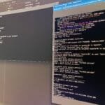
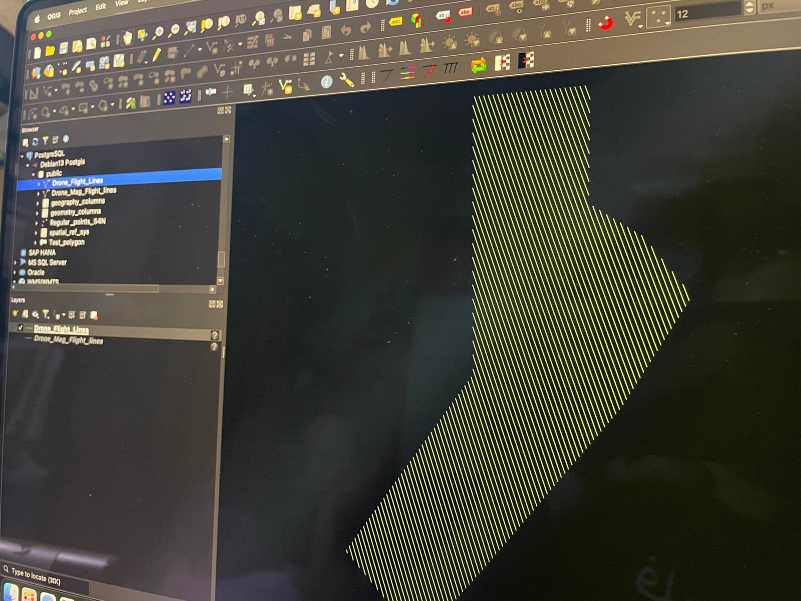
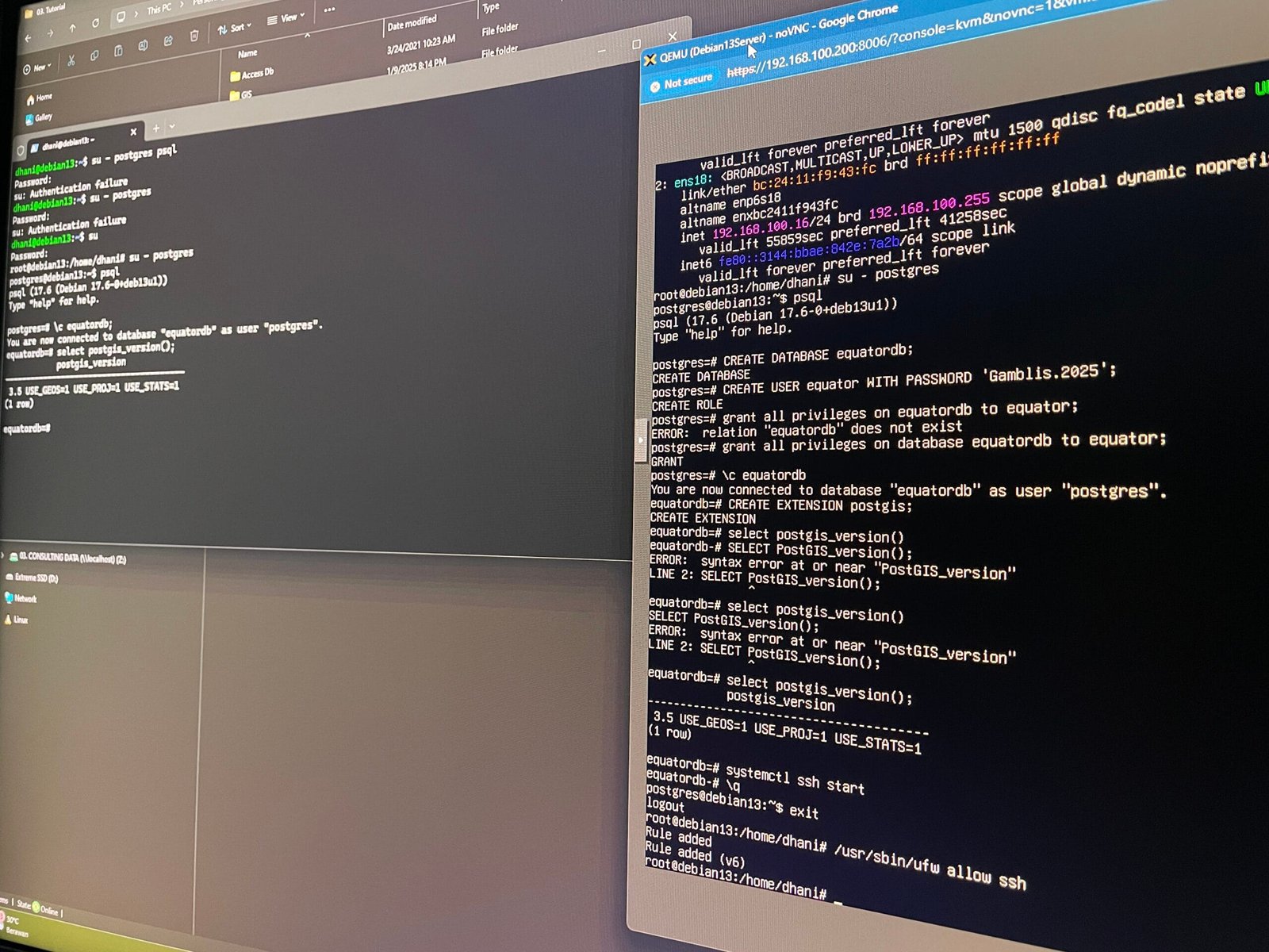
Skip to content
geodatainsights.com

geodatainsights.com

GIS and Database Tutorials for Beginners

  • Our Services
  • Contact
  • facebook.com
  • twitter.com
  • t.me
  • instagram.com
  • youtube.com
Subscribe
Top Stories
The Rise of GeoAI: How AI Is Transforming Geospatial Data
February 5, 2025
The Future of Sora: How AI Video Generation Will Change Everything
February 5, 2025
ChatGPT vs DeepSeek: A Comprehensive Comparison of AI Language Models
February 2, 2025
How to Fix CRS Mismatch Problems in QGIS: A Step-by-Step Guide
January 22, 2025
Introduction to Spatial Data in SQL Server: A Beginner’s Guide to Geospatial
January 9, 2025
person holding black iphone 4
Top 5 GIS Software in 2025: Which One Suits You?
January 8, 2025
Top 5 Spatial Databases for GIS Professionals in 2025
January 8, 2025
A sleek laptop and smartphone placed on wooden flooring, showcasing contemporary technology.
How to Install Docker on Ubuntu 24.04
December 30, 2024
How to Install PostGIS on PostgreSQL Database
December 30, 2024
install postgresql using docker
How to Install PostgreSQL Using Docker in Windows 11
December 23, 2024
blue and yellow metal part on painted wall
A Complete Guide to Install PostGIS on Ubuntu 24.04
December 23, 2024
Installing SQL Server on Docker: A Step-by-Step Guide
December 23, 2024
How to Export Layer to PostGIS in QGIS
December 16, 2024
How to Install macOS Sequoia on Proxmox
December 16, 2024
Install PostGIS on Ubuntu 24.04
December 16, 2024
How to Export Raster to Geodatabase in ArcGIS Pro
December 15, 2024
Create Points from CSV File in QGIS
December 8, 2024
Micromine Tutorial – Create a New Project
December 8, 2024
How to Export Shapefiles to Geodatabase in ArcGIS Pro
July 29, 2024
How to Create a New Project in ArcGIS Pro
May 13, 2024
Posted inAI

The Rise of GeoAI: How AI Is Transforming Geospatial Data

If you’ve ever used Google Maps to navigate through traffic, checked the weather forecast on your phone, or seen a drone-captured map of a disaster-stricken area, you’ve interacted with geospatial…
Continue Reading
Posted by geodatainsights.com February 5, 2025
Posted inAI

The Future of Sora: How AI Video Generation Will Change Everything

AI-generated video is no longer just a futuristic fantasy—it’s happening right now. With OpenAI’s Sora, we’re stepping into a world where creating stunning, high-quality videos is as simple as typing…
Continue Reading
Posted by geodatainsights.com February 5, 2025
Posted inTechnology

ChatGPT vs DeepSeek: A Comprehensive Comparison of AI Language Models

Introduction In the rapidly evolving world of artificial intelligence, language models like ChatGPT and DeepSeek have emerged as powerful tools for businesses, developers, and individuals alike. Both models are designed…
Continue Reading
Posted by geodatainsights.com February 2, 2025
Posted inQGIS

How to Fix CRS Mismatch Problems in QGIS: A Step-by-Step Guide

Experiencing Coordinate Reference System (CRS) mismatches in QGIS can be a common hurdle for both novice and seasoned GIS professionals. These mismatches often result in layers not aligning correctly, leading…
Continue Reading
Posted by geodatainsights.com January 22, 2025
Posted inDatabase

Introduction to Spatial Data in SQL Server: A Beginner’s Guide to Geospatial

In the era of data-driven decisions, location-based insights have become a game-changer for businesses and organizations. From mapping customer demographics to planning infrastructure projects, spatial data plays a pivotal role.…
Continue Reading
Posted by geodatainsights.com January 9, 2025
person holding black iphone 4
Posted inArticle

Top 5 GIS Software in 2025: Which One Suits You?

Introduction to GIS Software and its Importance GIS software is a key tool across industries for analyzing and interpreting spatial data. It helps capture, store, manage, and visualize geographic information,…
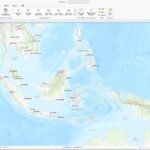
Continue Reading
Posted by geodatainsights.com January 8, 2025
blue and yellow metal part on painted wall
Posted inDatabase

A Complete Guide to Install PostGIS on Ubuntu 24.04

What is PostGIS PostGIS is an extension for the PostgreSQL relational database management system that provides support for geographic objects. It allows users to store, query, and manipulate geospatial data,…
Posted by geodatainsights.com December 23, 2024
Installing SQL Server on Docker: A Step-by-Step Guide
Posted inDatabase

Installing SQL Server on Docker: A Step-by-Step Guide

Introduction There are various ways to install Microsoft SQL Server. If you are using Mac, you may want to install SQL Server using Docker. SQL Server is available natively for…
Posted by geodatainsights.com December 23, 2024
How to Export Layer to PostGIS in QGIS
Posted inDatabase QGIS

How to Export Layer to PostGIS in QGIS

In the previous tutorial we learn how to install PostGIS on Ubuntu 22.04. Now we are going to show you how to export layer from QGIS to PostGIS database. In…
Posted by geodatainsights.com December 16, 2024
How to Install macOS Sequoia on Proxmox
Posted inmacOS

How to Install macOS Sequoia on Proxmox

In this article, we will guide you through the process of installing macOS Sequoia on a Proxmox virtualization environment. Proxmox is a powerful open-source platform that allows us to power…
Posted by geodatainsights.com December 16, 2024
Install PostGIS on Ubuntu 24.04
Posted inDatabase

Install PostGIS on Ubuntu 24.04

This tutorial will guide you to install PostGIS on Ubuntu 24.04. PostGIS is a PostgreSQL extension that will enable us to store spatial data into the PostgreSQL database. It is…
Posted by geodatainsights.com December 16, 2024

Posts pagination

Previous page 1 2 3 4 Next page

Recent Posts

  • The Rise of GeoAI: How AI Is Transforming Geospatial Data
  • The Future of Sora: How AI Video Generation Will Change Everything
  • ChatGPT vs DeepSeek: A Comprehensive Comparison of AI Language Models
  • How to Fix CRS Mismatch Problems in QGIS: A Step-by-Step Guide
  • Introduction to Spatial Data in SQL Server: A Beginner’s Guide to Geospatial

Categories

  • AI
  • ArcGIS Pro
  • Article
  • Blog
  • Database
  • macOS
  • Micromine
  • QGIS
  • Technology
You May Have Missed
Posted inAI

The Rise of GeoAI: How AI Is Transforming Geospatial Data

Posted by geodatainsights.com February 5, 2025
Posted inAI

The Future of Sora: How AI Video Generation Will Change Everything

Posted by geodatainsights.com February 5, 2025
Posted inTechnology

ChatGPT vs DeepSeek: A Comprehensive Comparison of AI Language Models

Posted by geodatainsights.com February 2, 2025
Posted inQGIS

How to Fix CRS Mismatch Problems in QGIS: A Step-by-Step Guide

Posted by geodatainsights.com January 22, 2025
Copyright 2025 — geodatainsights.com. All rights reserved. Bloghash WordPress Theme
Scroll to Top